When it comes to understanding weather in the next few hours to a couple of days, short-term forecast models are essential tools for meteorologists and weather hobbyists alike. Three of the most widely used models in the United States are the NAM, HRRR, and RAP. Each offers unique strengths and is designed for different forecasting needs. In this post, we will break down what these models are, how they work, and how you can use them to sharpen your short-term weather forecasts.
What Are Short-Term Forecast Models?
Short-term forecast models are computer simulations that predict weather conditions over a relatively short period, usually up to 84 hours or less. They use a variety of observational data—such as satellite imagery, radar, surface observations, and upper-air balloon readings—to simulate the state of the atmosphere. These models update frequently and provide high-resolution output, making them ideal for tracking rapidly changing conditions like thunderstorms, fog, and temperature swings.
The NAM Model (North American Mesoscale)
The North American Mesoscale (NAM) model is a high-resolution model that provides forecasts out to 84 hours in the future. It covers North America and is updated four times daily by NOAA. The NAM is useful for medium-range short-term forecasts and includes detailed vertical information about the atmosphere, making it helpful for forecasting precipitation, severe weather, and winter storms. It has a horizontal resolution of about 12 km in its parent domain, but a higher-resolution version (NAM Nest) operates at 3 km and focuses on smaller-scale features.
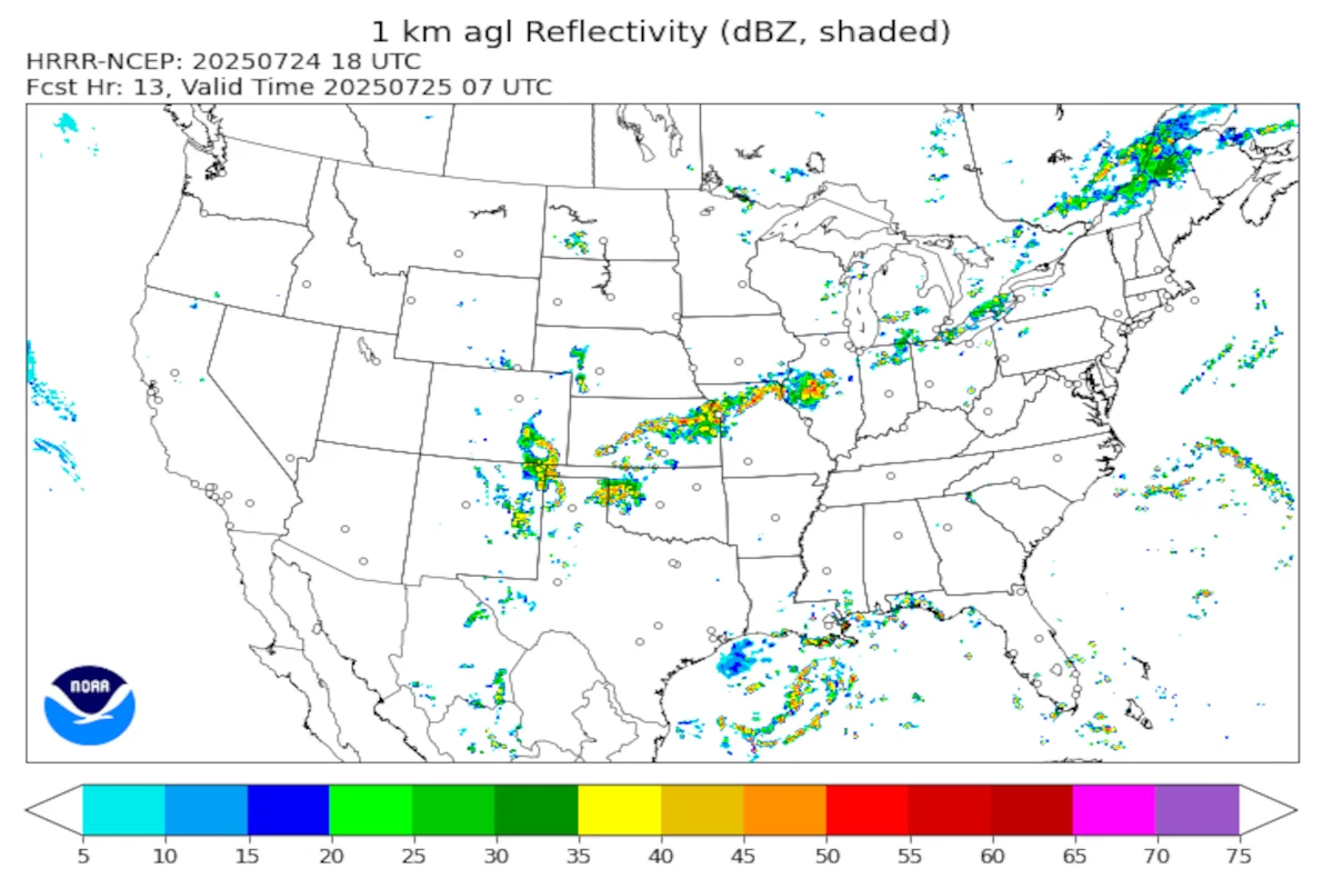
The HRRR Model (High-Resolution Rapid Refresh)
Meteorologists recognize the High-Resolution Rapid Refresh (HRRR) model for its extremely fine detail and frequent updates. It runs every hour and provides forecasts up to 18 hours ahead. Its 3 km resolution allows it to capture small-scale features like individual thunderstorms and sea breeze boundaries. The HRRR is especially useful for short-term planning during rapidly evolving weather events. It ingests radar data to help improve storm tracking, and aviation professionals, emergency managers, and storm chasers often use it.
The RAP Model (Rapid Refresh)
The Rapid Refresh (RAP) model serves as a companion to the HRRR; however, it operates at a lower resolution (13 km) and provides forecasts up to 51 hours. Like the HRRR, it updates hourly and focuses on short-term forecasting needs. In addition, NOAA designed the RAP for a broad range of applications including wind energy forecasting, aviation, and general short-range weather prediction. Although it is not as detailed as the HRRR, its broader coverage and longer forecast window still make it a valuable tool.
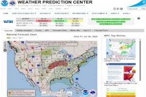
How to Access These Models
All three models can be accessed for free through NOAA and other weather data sites. Some of the most user-friendly platforms include:
NOAA/Model Analyses and Guidance
For example, these sites offer easy-to-read model maps, looped animations, and a variety of parameter overlays, including temperature, wind, radar reflectivity, and precipitation.
Which Model Should You Use?
Choosing the right model depends on what you are trying to forecast:
- Use HRRR for hour-by-hour updates and fine-detail forecasts
- Use RAP for general short-term forecasting up to 2 days
- Use NAM for more detailed mesoscale forecasting up to 3.5 days out
Many forecasters compare output from multiple models to find consensus or identify uncertainty.
Short-term weather models like NAM, HRRR, and RAP offer powerful insights for anyone interested in observing and predicting weather conditions in the near future. By learning how each model works and what it excels at, you can improve your forecasting skills and better understand the science behind short-term weather predictions.
Wondering about El Niño/La Niña and need some tools? Check out Understanding El Niño and La Niña Effects on US Weather.